Nepal's monsoon runs from roughly mid-June to late September and delivers about 80% of the country's annual rainfall in that window. Flooding concentrates in the lowland Terai plains, river valleys, and along road corridors. Landslides close highways. Rivers burst banks in built-up areas.
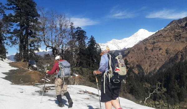
What this rarely does is close a high-altitude trekking route. Trails to Everest Base Camp, Annapurna Base Camp, Langtang and the rest sit hundreds or thousands of metres above the rivers that flood. By the time the autumn season opens in late September, trails have dried and the disruption that remains is on the roads, not the mountains.
So the practical risk to your trek isn't drowning. It's a landslide adding four hours to a drive, or a cancelled flight eating a day of your itinerary.
Why Nepal floods
Understanding the mechanism tells you far more about your own exposure than a headline does.
The rain is concentrated. Three months carry most of the year's precipitation. Rivers that are ankle-deep in April become genuinely dangerous in July.
The geology is young. The Himalaya are still rising, the rock is fractured, and the slopes are steep. Saturated soil on a steep slope moves. This is why landslides — not flooding — are the main cause of road closures affecting trekkers.
Cloudbursts are intensely local. One valley can take an extraordinary volume of rain in a few hours while the next valley stays dry. This is why "Nepal is flooded" is nearly always misleading. Conditions can differ completely across forty kilometres.
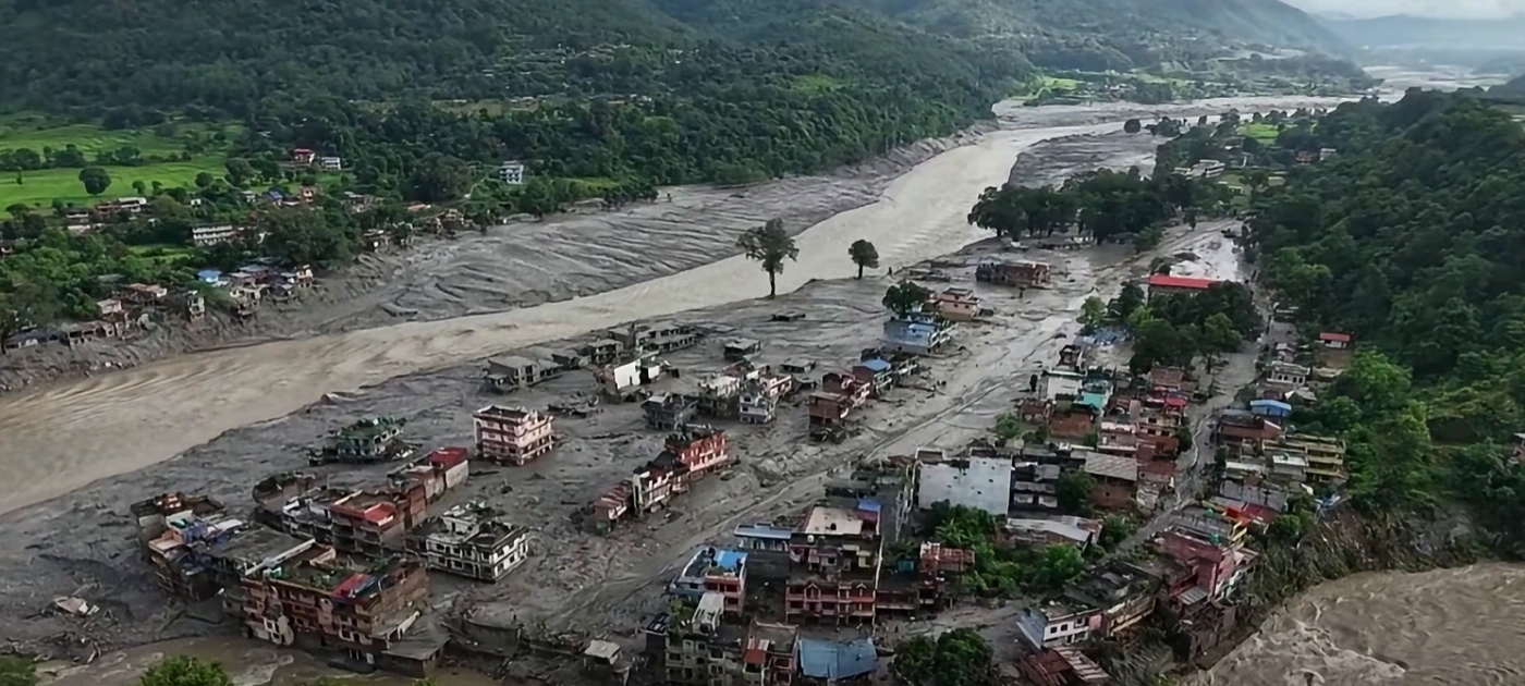
Glacial lake outburst floods are a growing hazard. As glaciers retreat, meltwater pools behind unstable moraine dams. When one fails, the surge moves fast and far. In August 2024, a GLOF above Thame in the Khumbu destroyed a significant part of the village — a Sherpa settlement on the Everest region's classic acclimatisation loop. In July 2025, a flood on the Bhotekoshi in Rasuwa wrecked infrastructure at the Nepal–China border crossing. These remain rare on any given trail in any given season, but they're no longer freak events, and serious operators now factor known flood paths into route and camp planning.
Development amplifies it. Riverbank construction, road-cutting without drainage, and building on floodplains turn recoverable rain into destruction. The late-September 2024 floods, which killed more than two hundred people nationwide and submerged parts of the Kathmandu Valley, were made considerably worse by encroachment on the Bagmati and Nakkhu river corridors.
How flooding affects each trekking region
None of the below is a live status report — conditions change weekly and you should confirm with your operator before you travel. What it does tell you is each region's characteristic weak point, which is the thing worth asking about.
Everest / Khumbu. The trail itself is high and drains well. The exposure is air access: Lukla flights are governed by cloud and wind, and in busy seasons departures often shift from Kathmandu to Manthali in Ramechhap, adding a pre-dawn road transfer. The overland alternative via Salleri is long and landslide-prone in a wet year. Build buffer days here more than anywhere else.
Annapurna (Base Camp, Circuit, Poon Hill). The trails are robust. The pressure point is the Prithvi Highway between Kathmandu and Pokhara, which is the most landslide-exposed stretch of road most trekkers will ever travel. Flying that leg costs little and removes the single biggest source of delay in the region.
Langtang. The closest major trek to Kathmandu, and the one most reliably affected by road conditions. The Pasang Lhamu Highway to Syabrubesi is narrow, cut into steep ground, and slides regularly after heavy rain. Ask specifically about it.
Manaslu. Road access up the Budhi Gandaki is rough and monsoon-sensitive; the trek itself begins low and climbs through a river valley, so early-season conditions matter more here than on higher routes.
Upper Mustang and Dolpo. These sit in the rain shadow north of the main Himalayan range and stay dry while the rest of the country is soaked. They are the exception to everything above — genuinely good monsoon trekking, and unaffected in most flood years.
Kanchenjunga and Makalu. Remote, with long road approaches through eastern Nepal. The trekking is fine; the drive is the variable.
Is it safe to trek right now?
The useful version of the question is: safe when?
During the monsoon (June to mid-September). Possible, but compromised. Leeches, cloud-obscured views, slippery ground, elevated landslide risk on approach roads, and frequent flight delays. Not the season for a first trek — with the rain-shadow regions as the honest exception.
Autumn (late September to November). Nepal's flagship season, deservedly. The rain stops, the air clears to its best visibility of the year, and temperatures are comfortable. By mid-October, flooding is simply not a factor in trail conditions. What can linger from a heavy monsoon is road damage — a highway hit in August may still be on single-lane diversion in October.
The realistic risks for an autumn trekker following a bad monsoon, in order of likelihood:
Road delays. A landslide turns a seven-hour drive into eleven. By far the most common disruption.
Flight cancellations. Lukla and Pokhara flights are weather-dependent regardless of flooding.
Trail reroutes. Occasionally a bridge or trail section washes out and a temporary diversion adds an hour. Guides know these within days.
Reduced teahouse capacity in a directly affected village. Rare, but relevant to itinerary planning where it applies.
Conspicuously absent from that list: being caught in a flood at altitude. High trails are, almost by definition, above the water.
What this means for your booking
Build in two buffer days, not one. If a road or flight goes wrong, two days absorbs it and one usually doesn't. Put them at the end, before your international flight.
Check your insurance covers three specific things: helicopter evacuation, your maximum trekking altitude, and trip interruption or delay. Standard travel policies frequently exclude trekking above 4,000 metres entirely — which rules out most of what people come to Nepal for.
Fly the long approaches where the budget allows. Kathmandu to Pokhara is twenty-five minutes in the air against a highway drive that carries most of your trip's road risk.
Ask your operator direct questions. Have you run this route since the monsoon? What did your last group report? What's the plan if the road to the trailhead closes? Vagueness in reply is a warning sign.
Don't cancel on a headline. International coverage rarely distinguishes the Terai plains from the high Himalaya. They're different places with different conditions, several thousand metres apart.
Why cancelling hurts more than it helps
Tourism accounts for roughly 6–7% of Nepal's GDP and supports a far larger share of livelihoods in mountain districts, where the alternatives are subsistence farming and labour migration. In a trekking village, one season's income covers the year.
The pattern after every major flood is the same, and it is deeply unfair. Damage hits one region. Headlines flatten it into "Nepal." Bookings collapse nationwide. The mountain communities never touched by the flood lose their season anyway. After the 2024 floods, operators reported cancellations for treks in areas that had sustained no meaningful damage at all.
If you want to help, the most effective thing you can do is come, and spend locally:
Book through Nepali-owned operators rather than foreign resellers
Stay in family-run teahouses rather than chain lodges
Hire local guides and porters, pay properly, and confirm your operator insures its porters
Eat and buy in the villages you walk through instead of carrying everything in
Where a specific region has been damaged, ask your operator whether a named, established local relief effort is worth supporting — and verify before donating
Pre-departure checklist
Confirm current trail and road status with your operator within seven days of departure
Verify insurance covers helicopter evacuation and your maximum altitude
Register with your embassy in Kathmandu
Download offline maps — mobile data is unreliable in deep valleys
Bookmark the Department of Hydrology and Meteorology for forecasts
Hold two buffer days and flexible international flight terms where possible
Pack a proper rain shell and pack cover even in autumn
Carry water purification; waterborne illness risk rises after flooding
Save your operator's 24-hour emergency number offline
Check current permit and TIMS requirements for your route
Frequently asked questions
Is Nepal safe to visit after floods?
For the standard trekking regions, yes. High-altitude trails sit well above the flood-prone river valleys and Terai plains. The practical impact on visitors is road access, not trail safety. Check which specific region is affected before making any decision.
Are Everest Base Camp and Annapurna Base Camp treks open during and after the monsoon?
Both trails remain open year-round and are unaffected by lowland flooding. Access is the variable: Lukla flights for Everest, and the Kathmandu–Pokhara highway for Annapurna. Confirm both with your operator close to departure.
When is the best time to trek in Nepal after a monsoon?
Mid-October to late November. Trails have dried, visibility is at its annual best, temperatures are comfortable, and monsoon road repairs are typically complete. March to May is the second season — rhododendrons in bloom, but hazier mountain views.
Will flooding affect flights to Lukla?
Lukla flights are governed by cloud and wind rather than flooding. Delays and cancellations are common in every season, which is the standing reason to build buffer days into any Khumbu itinerary.
Can I trek during the monsoon itself?
Yes, in the rain-shadow regions. Upper Mustang, Dolpo and parts of Manang stay dry while the rest of the country is soaked, and they're arguably at their best then. Elsewhere, expect leeches, cloud, slippery ground and limited views.
What is a GLOF, and should I worry about one?
A glacial lake outburst flood occurs when a natural dam holding back glacial meltwater fails. They are a real and increasing Himalayan hazard, but remain statistically rare on any given trek. Reputable operators plan routes and campsites with known flood paths in mind.
Should I cancel my trip if there's flooding in Nepal?
Find out which region is affected first. Nepal is geographically diverse, and flooding in the Terai or a single river valley usually has no bearing on conditions in the trekking areas. Talk to your operator before deciding.
The bottom line
Floods are part of the monsoon in Nepal, and climate change is sharpening the extremes. That's real and worth taking seriously. But the distance — physical and practical — between a flooded lowland river and an autumn trail at 3,500 metres is enormous, and collapsing the two costs mountain communities their livelihoods for no safety benefit to anyone.
Come in autumn. Bring buffer days. Book locally. Ask direct questions and expect direct answers.
Planning an autumn 2026 trek? Get in touch for current, on-the-ground conditions on your route.